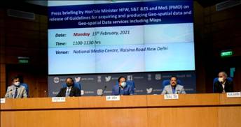
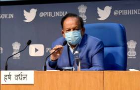
The Government has announced liberalised guidelines for geo-spatial data. Giving details of the liberalised guidelines at a media briefing in New Delhi today, the Union Minister for Science & Technology, Earth Sciences and Health & Family Welfare, Dr. Harsh Vardhan today said that by liberalizing the geo-spatial guidelines, the government has taken a historic decision that will lead to a One Lakh Crore Rupees Geo-Spatial economy. Addressing a media briefing, he said it will enable science to become a public movement and also to deliver a New India to people of the country.
Dr. Jitendra Singh, Minister of State for the Ministry of Development of North Eastern Region; Prime Minister's Office; Personnel, Public Grievances and Pensions; Department of Atomic Energy and Department of Space; Professor Ashutosh Sharma, Secretary, DST and Shri Sunil Kumar, Joint Secretary, DST, were also present on the occasion.
Dr. Harsh Vardhan said, “ The next generation of technologies will use hyper-resolution maps. Availability of comprehensive, highly accurate, granular and constantly updated representation of Geospatial Data will significantly benefit diverse sectors of the economy and will significantly boost innovation in the country and greatly enhance the preparedness of the country for emergency response The availability of data and modern mapping technologies to Indian companies is also crucial for achieving the vision of AtmaNirbharBharat and a five trillion-dollar economy”.
The Minister highlighted,“With the advent of publicly available geospatial services, a lot of Geospatial Data that used to be in restricted zone are freely and commonly available now and some of the policies/guidelines that used to regulate such information have been rendered obsolete and redundant”. “What is readily available globally does not need to be regulated. For Indian entities, there would be complete deregulation with no prior approvals, security clearances, licenses, etc. for acquisition and production of geospatial data and geospatial data services including maps”, he declared.
Dr. Harsh Vardhan pointed out, “All geospatial data produced using public funds, except classified geospatial data collected by security/law enforcement agencies, will be made accessible for scientific, economic and developmental purposes to all Indian Entities and without any restrictions on their use. Government agencies and others need to collaborate and work towards openlinked geospatial data”. “Stakeholders benefitted will include practically every segment of society, from industry to academia to government departments”, he emphasised. This is a transformative reform, the Minister added.
Speaking on the occasion, Union Minister of State (Independent Charge) Development of North Eastern Region (DoNER), MoS PMO, Personnel, Public Grievances, Pensions, Atomic Energy and Space, Dr. Jitendra Singh said that the Centre has taken a historic decision to completely deregulate Geospatial Map-making and unshackle the Geospatial sector in India for the first time. He said that the decision is an extension of a series of visionary reforms undertaken in the Space sector. He pointed out that today’s announcement heralds the unlocking of geo-mapping from restrictive use to wider use in the interest of nation building and creating an AtmaNirbhar Bharat.

Dr Jitendra Singh said, this is one more distinct example of removal of some of the colonial legacies that India was still grappling with and added that deregulation of Map-making is historic in the sense that Geo-Map is now going to be recognised as an instrument for development rather than only a tool for securing the country.
Dr. Jitendra Singh also invited lndian businesses to take lead and utilize the opportunities being thrown open for the making of Atmanirbhar Bharat. He said, the collaborative efforts from industry, academia and Government will make India a World leader in Geospatial knowledge. The Minister urged all sections to grab the opportunity and fulfil the aspirations of the nation to become a five trillion-dollar economy.
Secretary, DST ,Professor Ashutosh Sharma gave a presentation on the Geo Spatial guidelines. He said, the new guidelines will be “Stimulating and empowering INDIAN industry and Surveying Agencies without diluting security concerns. Atmanirbharta in Geospatial products and solutions, will be a one lakh crore business by 2030 plus economic impact through development”.
To realise India's vision of Atmanirbhar Bharat and the goal of a 5 trillion-dollar economy, the regulations that apply to geospatial data and maps henceforth stand radically liberalised. The Department of Science and Technology has announced sweeping changes to India’s mapping policy, specifically for Indian companies. What is readily available globally does not need to be restricted in India and therefore geospatial data that used to be restricted will now be freely available in India. Furthermore, our corporations and innovators are no longer subject to restrictions nor do they require prior approvals before they collect, generate, prepare, disseminate, store, publish, update digital Geospatial Data and Maps within the territory of India.
Click here for Guidelines
*****
NB/KGS/(DST Media Cell)