Ministry of Electronics & IT
Signing of Memorandum of Understanding (MoU) between Digital India BHASHINI Division and Survey of India for Toponymic Data Digitisation
Posted On:
21 JAN 2026 2:30PM by PIB Delhi
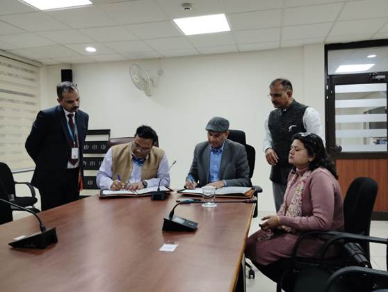
The Digital India BHASHINI Division (DIBD), Ministry of Electronics and Information Technology (MeitY), signed a Memorandum of Understanding (MoU) with the Survey of India (SoI) on 20 January 2026 to support the digitisation, transcription and standardisation of geographical place names (toponyms) using AI-based speech and language technologies. The collaboration will strengthen the creation of accurate, multilingual and standardised toponymic datasets aligned with the National Geospatial Policy, 2022.
The Survey of India, as the national nodal agency for standardisation and maintenance of geographical names, undertakes large-scale toponymic field surveys to collect place names in local vernacular languages for integration into national mapping systems. Under this collaboration, BHASHINI’s speech-to-text and language processing capabilities will be used to convert large volumes of audio recordings of place names into structured digital text, supporting the creation of a comprehensive and validated Toponymy Database covering more than 16 lakh locations.
The collaboration will support the development of the National Geographical Name Information System (NGNIS) by enabling efficient processing of field-collected audio data into local language scripts, Devanagari, Roman and other formats, ensuring consistency across national maps, digital platforms and governance systems. The integration of automatic speech recognition, language normalisation and validation workflows will significantly enhance the speed, accuracy and scale of toponym data processing.
The initiative will also strengthen audio documentation of place names, preserving correct pronunciation and local linguistic variations, while enabling systematic standardisation through alignment with the Survey of India Toponymy Manual and Bureau of Indian Standards (BIS) code of practices. This will improve the reliability of place-name datasets used across Open Series Maps, governance platforms and public information systems.
Through this partnership, the Digital India BHASHINI Division will contribute its speech and language AI portfolio to support data creation, annotation and validation pipelines, enabling large-scale conversion of human speech into high-quality geospatial language datasets. The collaboration reflects BHASHINI’s approach of embedding language AI across national digital public infrastructure systems where linguistic accuracy is critical for service delivery and decision-making.
The MoU reinforces the role of language technologies in strengthening India’s geospatial ecosystem, ensuring that place names across regions and dialects are accurately captured, preserved and standardised for governance, disaster management, infrastructure planning and citizen services. The collaboration aligns with the Government of India’s vision of building indigenous, AI-enabled digital infrastructure rooted in Indian linguistic realities.

****
MSZ
(Release ID: 2216831)
Visitor Counter : 1193